
Remote Sensing
Defined.
Remote Sensing/Monitoring contains mass amounts of valuable information, if you have the right technology in place. Images are captured on sensors mounted on aircraft, unmanned drones or satellites. Imagery of these types are increasingly used in many areas such as commercial industry, scientific research, emergency and resource management and security and reconnaissance.
Remote sensing also allows data to be retrieved in places where humans cannot access such as over volcanic mountains, the ocean depths and other locations; all unobstructed.
Technology.
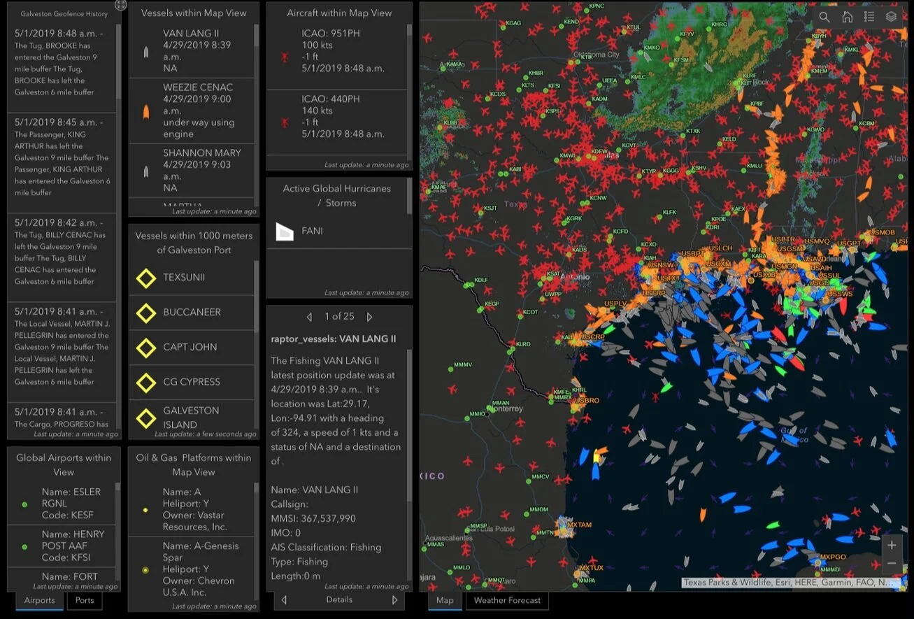
40Geo, LLC’s unmatched GIS Platform, Raptor, is designed to capture, store, manage, analyze, manipulate, and present geographic or spatial data. The system integrates with a back-end database that can be used for queries and analysis of the maps and allows users to link the database to the maps with a well-defined front-end interface.
Combining the power of GIS and Machine learning with Raptor, 40Geo, LLC can transform this unstructured data into geospatial information products. Products from which you can derive results and actionable information.
Remote sensing and GIS work together to enable our clients to visualize the data from virtually any geographic position on Earth, including data from dangerous or inaccessible areas.
Results.
GIS remote sensing provides manipulative data and images of areas in a fast and cost-efficient manner, enabling our clients to see what is happening, in real-time, in any given area.
Remote sensing is also an unobstructed method, allowing users to collect data and perform data processing offsite, and without disturbing the target area or object
Remote sensing technology relies upon technical instruments to collect data over large areas which reduce the manual work that could otherwise have required a lot of people to do; therefore increasing our clients ROI.